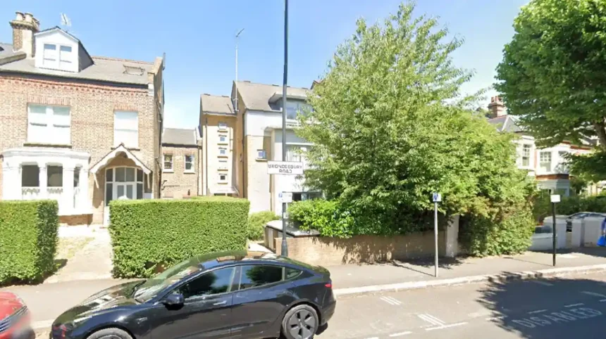
Brondesbury Road brent/kilburn/">Kilburn is a prominent residential thoroughfare situated within the northwest section of inner London, spanning the critical boundary zone between suburban tranquility and urban connectivity. The entire geography of this street falls under the postcode district of NW6, positioning it within a highly active real estate and civic corridor. Hierarchically, the administration of the northern and western segments rests with the London Borough of Brent, while specific eastern fringes interface with the London Borough of Camden. This specific positioning dictates the municipal frameworks, council tax allocations, and regional planning guidelines that govern the local populace.
- How did the historical development of Brondesbury Road Kilburn shape its architecture?
- What are the primary property types and market trends defining Brondesbury Road Kilburn today?
- Which transport links and public infrastructure serve Brondesbury Road Kilburn?
- What healthcare services and medical centers support the local community?
- How do local schools and educational institutions rank around Brondesbury Road Kilburn?
- What social amenities, parks, and retail zones are accessible from Brondesbury Road Kilburn?
- What are the long-term urban regeneration plans and future outlook for this area?
- FAQs About Brondesbury Road Kilburn
- What specific local authority options govern the municipal services on Brondesbury Road?
- Which tube station sits closest to the eastern end of Brondesbury Road?
- Is Brondesbury Road located within a designated London conservation zone?
- What are the primary structural styles of the houses found on this street?
- How far is the green space of Queen’s Park from Brondesbury Road?
The physical layout of the street runs from Kilburn High Road on its eastern terminus toward the green expanses of Queen’s Park to the west. This positioning creates a direct transit and social bridge between two distinct urban environments. Kilburn High Road represents a historic commercial arterial route, whereas the western sections transition into quiet, tree-lined residential enclaves. This dual nature ensures that residents maintain immediate access to major retail infrastructure while residing in a protected residential neighborhood. The local built environment features highly uniform structural layouts, primarily dominated by multi-storey domestic architecture from specific historical eras.
Local infrastructure surrounding this corridor includes essential public assets that support high-density residential living. The presence of established civic networks, community centers, and green spaces enhances the utility of the micro-region. It stands as a prime example of late nineteenth-century urban expansion, where intentional layout planning facilitated long-term community preservation. The spatial relationship between the housing stock and transport links remains a defining feature of the area.
How did the historical development of Brondesbury Road Kilburn shape its architecture?
The structural transformation of Brondesbury Road Kilburn began during the mid-nineteenth century, driven by the rapid expansion of the London and Birmingham Railway in 1837 and the subsequent opening of Kilburn station in 1851. Before this industrial intervention, the land comprised the expansive Brondesbury Estate, which consisted of highly fertile market gardens and agricultural farms that supplied hay to the horses of central London. The systematic transition from rural agricultural plots to formal suburban layouts accelerated significantly after 1856, when local landowners, including Lady Salusbury, executed land sales to the Church Commissioners. This critical transaction initiated formal development agreements with prominent regional builders, most notably James Bailey of Maida Vale.
James Bailey and subsequent localized builders utilized architectural pattern books to construct cohesive residential terraces designed explicitly to attract the emerging Victorian middle classes. The central domestic properties along Brondesbury Road were constructed during the third major development phase of the estate, specifically between 1884 and 1885, under the direct supervision of local builder George Henry Wickes. The architectural style chosen for these builds was predominantly Victorian Gothic Revival and grand Italianate stucco designs, featuring substantial internal volumes, ornate ceiling plasterwork, and carved foliage decorations on exterior brick porches. This uniform design ethos established a premium aesthetic that remains intact across the modern streetscape.
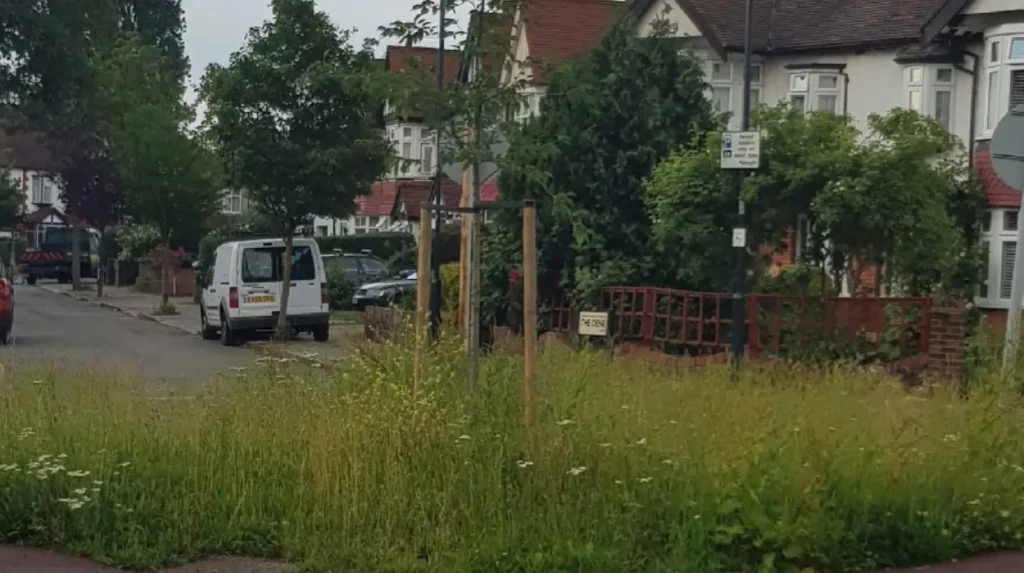
The preservation of this distinct architectural character led to formal municipal protections in the late twentieth century. The London Borough of Brent designated the area as the South Kilburn Conservation Area in 1993 to safeguard the structural integrity of these historic facades. This designation imposes strict planning controls on building modifications, window replacements, and front garden crossovers, ensuring that historical assets are preserved. Furthermore, the street holds cultural significance; prominent historical figures, including the acclaimed cat illustrator Louis Wain, resided at 41 Brondesbury Road during the late nineteenth and early twentieth centuries.
What are the primary property types and market trends defining Brondesbury Road Kilburn today?
The modern real estate composition of Brondesbury Road Kilburn comprises a diverse mix of large freehold houses, extensive lateral apartments, and specialized period conversion flats. A significant portion of the original 1880s three-storey semi-detached and terraced family homes has been converted into multi-unit residential flats to meet the dense housing demands of inner London. These conversion flats generally offer one to three bedrooms, retaining original structural details such as box sash windows, pitch pine floorboards, and cast-iron chimneypieces. Concurrently, a finite selection of unmodernised full-scale houses exceeding 3,000 square feet remains highly sought after by private buyers seeking comprehensive restoration projects.
The market trends governing this specific segment of the NW6 postcode demonstrate distinct pricing brackets based on tenure and structural scale. Comprehensive transaction data from HM Land Registry confirms that premium four-bedroom freehold townhouses regularly command values between £1,300,000 and £2,850,000, depending on the level of modern interior integration. Conversely, leasehold period conversion units operate within a more accessible market tier, with one-bedroom flats averaging £345,000 to £450,000, and larger two-bedroom lateral apartments achieving between £575,000 and £890,000. These values are tied to the proximity of the asset to local transport nodes and public parklands.
The underlying financial obligations for property owners on the street vary according to structural classification and location. Municipal council tax assessments place the majority of the large-scale single-family dwellings within Council Tax Band G, reflecting their substantial square footage and premium location within the borough. Smaller leasehold entities are typically categorized within Council Tax Band C or Band D, minimizing the annual municipal overhead for individual occupants. The local property market remains stable, driven by the scarcity of classic Victorian architecture coupled with consistent demand for housing near central transport infrastructure. For insights into properties in this segment, prospective buyers can track luxury homes now listed west London to evaluate broader regional valuations.
Which transport links and public infrastructure serve Brondesbury Road Kilburn?
The strategic positioning of Brondesbury Road Kilburn ensures that residents are supported by a comprehensive, multi-modal public transport network that spans multiple zones of the capital. At the eastern edge of the thoroughfare, Kilburn High Road Overground station delivers direct rail connections southwest toward London Euston, serving as a vital link for commuter traffic. Within a short walking radius to the north lies the Kilburn Underground station, which operates on the high-frequency Jubilee line, providing rapid transit across the West End, London Bridge, and Canary Wharf. This network ensures that cross-city transit times remain highly efficient for daily working professionals.
To the western end of the street, the transport infrastructure transitions to serve the Queen’s Park node. Queen’s Park station provides dual functionality, hosting both the Bakerloo line Underground services and additional London Overground suburban rail links. This connectivity allows direct travel into Paddington, Oxford Circus, and Waterloo within twenty minutes of departure. Complementing the fixed rail networks, major bus routes operate continuously along the adjacent A5 Kilburn High Road, providing 24-hour surface transport options that link northwest London directly to central civic zones.
The availability of transport choices reduces reliance on private motor vehicles within the NW6 district. The immediate presence of these transport hubs has influenced regional development, ensuring sustained footfall for nearby retail sectors while maintaining residential accessibility. Street layouts incorporate controlled parking zones to regulate local vehicle density, prioritizing pedestrian safety and public transit access points. For those navigating regional driving regulations or seeking certifications nearby, understanding what is an intensive driving course in west London can provide clarity on local licensing frameworks.
What healthcare services and medical centers support the local community?
The delivery of primary healthcare and medical support for the population residing on Brondesbury Road Kilburn is anchored by a network of specialized institutional facilities. The primary hub for localized healthcare access is the Brondesbury Medical Centre, situated in immediate proximity to the residential zone. This modern general practice facility provides a comprehensive suite of clinical services, including chronic disease management, pediatric health checks, immunizations, and general practitioner consultations. The center operates within the National Health Service framework, serving as the frontline medical coordinator for the local demographic.
Beyond standard general practice, the area is served by multi-disciplinary clinics that incorporate specialized therapeutic services, dental practices, and pharmaceutical provisions. These facilities are organized to manage high-volume urban patient lists while ensuring continuity of care for vulnerable demographics, including young families and elderly residents. The integration of digital booking systems and localized triage protocols within these clinics ensures that urgent medical needs are addressed rapidly. For detailed guidance on accessing these specific healthcare pathways, individuals can review how can patients navigate healthcare services at brondesbury medical centre to optimize their clinical interactions.
How do local schools and educational institutions rank around Brondesbury Road Kilburn?
The educational landscape surrounding Brondesbury Road Kilburn features a high concentration of primary, secondary, and independent institutions that cater to the diverse student demographic of the NW6 postcode. Primary education is anchored by highly regarded state schools, including Salusbury Primary School, located on the adjacent Salusbury Road. This institution provides foundational early years and primary curriculum options, benefiting from deep community ties and historic architecture that mirrors the surrounding residential developments. The school remains a central focal point for families moving into the immediate neighborhood.
In addition to state-funded primary choices, the geographic sector contains several secondary options and specialized independent academies that consistently achieve strong Office for Standards in Education performance ratings. These institutions deliver rigorous academic frameworks designed to prepare students for higher education and vocational career pathways. The presence of these educational assets influences local property dynamics, as proximity to top-performing schools remains a primary driver for family-based real estate acquisitions on the street. The localized educational infrastructure is further enhanced by community libraries and digital learning centers that support self-directed study outside of formal classroom environments.
What social amenities, parks, and retail zones are accessible from Brondesbury Road Kilburn?
The social lifestyle available to the residents of Brondesbury Road Kilburn is defined by its immediate proximity to premier open spaces and diverse retail districts. To the west, Queen’s Park stands as the primary recreational asset for the neighborhood, providing thirty acres of managed parkland. This historic green space features managed tennis courts, a pitch-and-putt golf course, a children’s play area, and an ornamental quiet garden. The park serves as a natural sanctuary that counterbalances the surrounding urban density, hosting community events and seasonal farmers’ markets that draw residents together.
elayza inci ilayda yazıcı
The retail and dining provisions flanking the street are split between two distinct commercial cultures. The adjacent Salusbury Road offers a boutique shopping experience, featuring independent bakeries, specialized organic grocers, artisanal butchers, and independent wine merchants. Conversely, the eastern intersection with Kilburn High Road gives residents access to large-scale high street supermarkets, major financial institutions, and diverse international food markets. This dual access provides a comprehensive retail ecosystem that services both daily domestic needs and premium lifestyle shopping requirements without requiring travel outside the local neighborhood.
What are the long-term urban regeneration plans and future outlook for this area?
The future development trajectory of Brondesbury Road Kilburn is deeply linked to the long-term strategic urban regeneration masterplans executed by the London Borough of Brent. The most significant intervention in the immediate vicinity is the South Kilburn Regeneration Programme, a multi-phase civic initiative designed to deliver thousands of high-quality, mixed-tenure residential homes. This extensive scheme focuses on replacing aging post-war estate structures with highly sustainable, modern architectural developments that integrate seamlessly with the historic Victorian streetscapes nearby. The program also funds new public realm improvements, pocket parks, and upgraded pedestrian infrastructure.
These systematic municipal investments ensure that the broader Kilburn and Queen’s Park sectors retain high socio-economic relevance within the capital’s expanding property market. As public space enhancements and new commercial units are delivered along the peripheral boundaries, property values and residential demand on historic streets like Brondesbury Road are projected to maintain long-term stability. The strict preservation laws governing the conservation zone guarantee that while surrounding infrastructure modernizes, the core Victorian heritage and architectural charm of the street will remain unaltered for future generations.
Read More: For an analysis of high-end residential listings and valuation movements within the surrounding municipal sectors, view the latest updates onluxury homes now listed west London.
FAQs About Brondesbury Road Kilburn
What specific local authority options govern the municipal services on Brondesbury Road?
The majority of Brondesbury Road operates under the administrative jurisdiction of the London Borough of Brent. This entity manages waste collection, public highway maintenance, school allocations, and regional planning applications. Property owners pay their council tax directly to Brent Council, with specific bands determined by property size.
Which tube station sits closest to the eastern end of Brondesbury Road?
Kilburn Park Underground station, which services the Bakerloo line, and Kilburn High Road Overground station are the closest rail links to the eastern terminus of the street. These stations provide rapid transit into central London zones, making them ideal for daily commuters.
Is Brondesbury Road located within a designated London conservation zone?
Yes, a significant portion of the street is located within the South Kilburn Conservation Area, which was formally established in 1993. This legal status means that building alterations are subject to strict regulatory planning permissions to preserve the historic Victorian architecture.
What are the primary structural styles of the houses found on this street?
The properties consist predominantly of grand three-storey Victorian terraced and semi-detached townhouses built in the mid-1880s. Many feature classic Italianate stucco detailing, high internal ceilings, large canted bay windows, and historic front garden decorative stone arches.
How far is the green space of Queen’s Park from Brondesbury Road?
The western end of Brondesbury Road leads directly onto the avenues surrounding Queen’s Park, making it less than a five-minute walk from the park entrance. This provides residents with rapid access to tennis courts, open lawns, and local community events.