Walking routes in West London comprise a network of pedestrian paths, riverside trails, park circuits, and long-distance waymarked routes spanning boroughs including Kensington and Chelsea, fulham/hammersmith/">hammersmith-and-fulham/">Hammersmith and Fulham, Ealing, Brent, and Hillingdon. These routes provide access to Royal Parks, historic estates, canal towpaths, and nature reserves, serving residents, commuters, and visitors seeking recreation, fitness, and transport alternatives.
- What are the main types of walking routes in West London?
- Which riverside walking routes are most popular in West London?
- What are the best park walking circuits in West London?
- Which urban heritage walks showcase West London architecture and history?
- What long-distance trails pass through West London?
- How accessible are West London walking routes for different fitness levels?
- What wildlife and natural features can walkers observe on West London routes?
- How do walkers navigate and plan routes in West London?
- What are the health and community benefits of walking in West London?
What are the main types of walking routes in West London?
West London walking routes fall into four categories: riverside paths, park loops, urban heritage walks, and long-distance trails. Each type serves distinct purposes including fitness, sightseeing, commuting, and nature observation, with varying distances from under one kilometre to over 100 kilometres.
Riverside paths follow the River Thames and its tributaries such as the River Pinn, River Crane, and Grand Union Canal. The Thames Path National Trail runs through Hammersmith, hounslow/chiswick/">Chiswick, and Richmond, offering continuous towpath walking from Kew Bridge to Hammersmith Bridge and beyond. The Celandine Route follows the River Pinn for 11.8 miles (19 km) from Pinner to Cowley, passing Ruislip Lido and Brunel University. The Brentford Canal Walk covers 6.8 miles (11 km) along the Grand Union Canal from Brentford to Minet Country Park.
Park loops include circuits within individual green spaces such as Chiswick House and Gardens (1.2 miles), Ravenscourt Park (variable loops), Gunnersbury Park (perimeter and internal paths), and Walpole Park in Ealing. These routes typically range from 1 to 3 miles and feature landscaped gardens, playgrounds, cafés, and sports facilities. Syon Park, Osterley Park, and Boston Manor Park offer larger circuits with historic manor houses, lakes, and arboretums.
Urban heritage walks traverse residential streets, mews, and garden squares in neighbourhoods including Notting Hill, Kensington, South Kensington, Holland Park, and Chelsea. These self-guided routes highlight Victorian and Georgian architecture, hidden courtyards, and local landmarks such as Portobello Road, King’s Road, and museum districts. Distances vary from 2 to 5 miles depending on the area covered.
Long-distance trails include the Capital Ring (78.3 miles), London Loop (150 miles through outer London), and Jubilee Greenway (60 km). The Capital Ring passes through Richmond Park, Kew Gardens, and Brentford, connecting multiple West London boroughs. The Green London Way (100 miles) includes sections from Richmond to Kew Bridge and Kew Bridge to Hanwell.
Which riverside walking routes are most popular in West London?
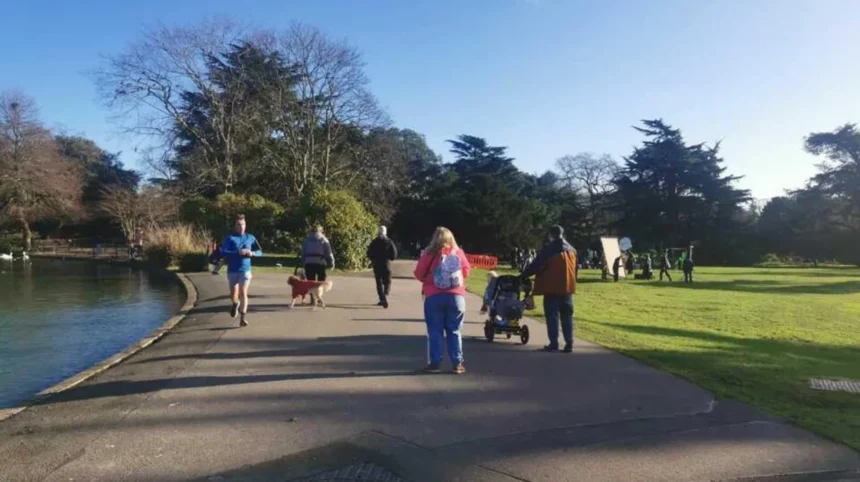
The Thames Path from Kew Bridge to Hammersmith Bridge ranks as the most frequented riverside walk, with Strand on the Green offering continuous river views and café access. This 3–5 mile section passes Chiswick House, Dukes Meadows, and Hammersmith Terrace, attracting walkers, runners, and dog owners daily.
The Kew Bridge to Hammersmith Bridge route follows the north bank of the Thames through Chiswick, passing landmarks including Chiswick Pier, Chiswick Eyot, and Hammersmith Bridge. Walkers encounter riverside pubs, independent cafés such as Dear Coco and Elderpress Café, and historic terraces dating to the 18th century. The path connects to Furnivall Gardens and Ravenscourt Park, enabling extended loops.
The Chiswick Riverside Walk forms a 7.1-mile (11.5 km) circular route from Chiswick station, crossing Chiswick Bridge, passing Duke’s Hollow Nature Reserve, Barnes Railway Bridge, and returning via Mortlake. This route includes detours to Chiswick House gardens and Leg of Mutton Reservoir, a Local Nature Reserve supporting mute swans, great crested grebes, and grey herons.
The Fulham Palace to Putney Bridge Thames Path covers approximately 6 miles, combining history at Fulham Palace, Bishop’s Park, and Putney Embankment. This section crosses Putney Bridge and links to Wandsworth and Battersea via the continuous Thames Path.
The River Crane walk through Crane Park in Twickenham offers a 2.5-mile (4 km) easy route with woodland, reedbed, and Crane Park Island Nature Reserve. Wildlife includes herons, water voles, kingfishers, and dragonflies, with the historic Shot Tower visible from the path.
The Celandine Route follows the River Pinn for 11.8 miles (19 km) from Pinner station through Ruislip, Hillingdon, and Ickenham to Cowley on the Grand Union Canal. The route passes Ruislip Lido, Bayhurst Wood Country Park, and Brunel University, with flora including lesser celandine flowers and fauna such as kingfishers and treecreepers.
What are the best park walking circuits in West London?
Chiswick House and Gardens, Gunnersbury Park, and Walpole Park provide the most accessible and well-maintained park circuits, with distances from 1 to 3 miles and clear signage. These parks feature landscaped paths, heritage buildings, and amenities including cafés, playgrounds, and museums.
Chiswick House and Gardens offers a 1.2-mile (2 km) loop through 65 acres of restored 18th-century gardens with classical vistas, artificial rivers, lakes, and a waterfall descending through three archways. The neo-Palladian villa, open seasonally, provides historical context to the landscape design inspired by symmetry and proportion.
Gunnersbury Park in Acton features perimeter and internal loops across expansive grounds, including the Orangery, Gunnersbury Park Museum, sports facilities, and Putt in the Park mini-golf. The park’s size allows both short strolls and longer circuits, with children’s playgrounds and café facilities supporting extended visits.
Walpole Park in Ealing combines open green spaces with defined paths around Pitzhanger Manor & Gallery, a Regency-era house designed by John Soane. Two playgrounds, a café, and proximity to Lammas Park enable combined walking routes exceeding 2 miles.
Ravenscourt Park in Hammersmith provides level paths through mature trees, a walled garden, tennis and basketball courts, and a café hosting local events. The park’s central location makes it a frequent stop for commuters and residents seeking midday exercise.
Syon Park near Brentford offers sweeping lawns, lakes, riverside paths, and views of Syon House, a historic stately home. The park’s Snakes and Ladders adventure play area attracts families, while the main parkland supports longer weekend walks.
Osterley Park in Isleworth presents a Georgian mansion used in film and television, surrounded by woodlands, meadows, and serene lakes. The estate’s “out-of-London” atmosphere appeals to walkers seeking tranquil, expansive settings within West London boundaries.
Boston Manor Park features a Grade I listed Jacobean manor house, restored walled gardens, children’s play areas, and tea rooms. The park’s historic architecture and varied terrain support both leisurely strolls and structured exercise routes.
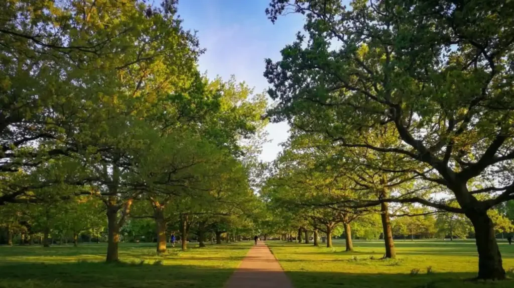
Richmond Park, though technically in South West London, serves West London residents with over 2,500 acres of ancient trees, grasslands, and wildflowers, plus grazing deer herds. The Capital Ring and Beverley Brook Walk traverse the park, offering routes from 2 to 10 miles.
Bushy Park near Hampton Court provides 5 miles (8 km) of trails through tranquil ponds, Cheshunt Avenue, and the Diana Fountain, with frequent deer sightings. The park’s proximity to the Thames and Hampton Court Palace enables extended walking itineraries.
Which urban heritage walks showcase West London architecture and history?
Notting Hill, Kensington, Holland Park, and Chelsea heritage walks reveal Victorian and Georgian streetscapes, mews houses, and garden squares through self-guided routes of 2 to 5 miles. These walks emphasize architectural detail, local history, and hidden urban spaces accessible only on foot.
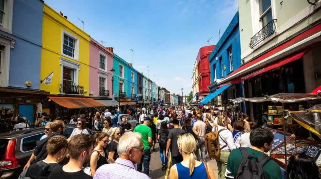
The Notting Hill walk explores side streets and mews beyond Portobello Road, highlighting colorful houses, cobblestone lanes, and local pubs. The route avoids main tourist thoroughfares, focusing on residential character and hidden courtyards that define the neighborhood’s charm.
The Kensington walk traverses streets and mews once occupied by residents, showcasing wisteria-clad facades in spring and historic pubs. The route connects to South Kensington, forming a continuous 4–6 mile exploration of museum districts, garden squares, and heritage buildings.
The Holland Park walk begins at Holland Park tube station, passing grand houses, unique mews, and the Kyoto Garden within Holland Park itself. Peacocks, tulip gardens, and high street shops provide variety, with the route emphasizing the area’s blend of urban density and green retreats.
The Chelsea walk covers back streets, secret gardens, and the King’s Road retail corridor, including Hans Town and St. Luke’s Church. The route references literary history, noting streets associated with John le Carré’s George Smiley, and highlights pastel houses and riverfront scenery.
The Hammersmith Riverside to Barnes Bridge walk (5 km return) combines industrial heritage at Hammersmith Bridge with natural reserves at Leg O’ Mutton and Barnes Pond. This route passes 18th-century terraces and riverside mansions, illustrating West London’s evolution from village to suburb.
The Fulham Palace to Putney Bridge route integrates Fulham Palace’s Bishop’s Park with Putney Embankment, offering views of rowing clubs and historic bridges. The walk’s 6-mile distance allows half-day exploration of ecclesiastical, sporting, and residential heritage.
What long-distance trails pass through West London?
The Capital Ring (78.3 miles), London Loop (150 miles), and Green London Way (100 miles) form the backbone of long-distance walking through West London, connecting Royal Parks, canals, and outer boroughs. These trails support multi-day hiking, section walking, and commuting alternatives.
The Capital Ring starts at Woolwich Foot Tunnel and passes through Eltham, Beckenham Place Park, Tooting Bec Common, Wimbledon Common, Richmond Park, Kew Gardens, and the Grand Union Canal to Harrow. The Richmond to Kew section (approximately 10 miles) offers continuous riverside and parkland walking, with access to Kew Bridge, Syon Park, and Brentford.
The London Loop circles outer London over 150 miles, passing through Hillingdon, Ealing, and Brent. Sections near West London include the Celandine Route (River Pinn), Colne Valley Trail, and Grand Union Canal Walk, providing waterside continuity.
The Green London Way (100 miles) divides into 18 sections, including Richmond to Kew Bridge (Section 9) and Kew Bridge to Hanwell (Section 10). These segments link Richmond Park, Kew Gardens, and Brentford, integrating with the Capital Ring and Thames Path.
The Jubilee Greenway (60 km) connects Regent’s Canal, Thames Path, and multiple Royal Parks, passing through Paddington, Kensington, and Hammersmith. The route supports urban commuting and leisure walking, with signage and maps available via Transport for London.
The Beverley Brook Walk (6.8 miles) follows the brook from Putney to New Malden through Barnes Common, Richmond Park, and Wimbledon Common. This trail passes Beverley Meads and Fishpond Local Nature Reserve, supporting kingfishers and mandarin ducks.
The Colne Valley Trail (6.8 miles) runs from Uxbridge to Rickmansworth along the Grand Union Canal and River Colne, passing Lynsters, Stocker’s, and Batchworth Lakes. The Colne Valley Way (10.6 miles) extends from Staines to Uxbridge, crossing Staines Moor and Wraysbury Reservoirs.
How accessible are West London walking routes for different fitness levels?
West London walking routes accommodate all fitness levels, with distances from 0.6 miles (Connaught Water) to 78.3 miles (Capital Ring), and terrain ranging from flat towpaths to moderate hill climbs. Accessibility features include surfaced paths, step-free access, and frequent rest points.
Easy walks under 3 miles include Connaught Water (0.6 miles), Brent Reservoir (0.7 miles), Chiswick House (1.2 miles), and Walpole Park (variable loops under 2 miles). These routes feature level, surfaced paths suitable for strollers, wheelchairs, and mobility aids.
Moderate walks between 3 and 7 miles include the Thames Path from Kew Bridge to Hammersmith Bridge (3–5 miles), Ravenscourt Park to Chiswick Mall (4 km), and Beverley Brook Walk (6.8 miles). These routes include some uneven surfaces, gentle inclines, and longer distances requiring moderate endurance.
Challenging walks exceeding 7 miles include the Celandine Route (11.8 miles), Chiswick Riverside Walk (7.1 miles), and Capital Ring sections (10+ miles). The London Loop and Green London Way demand multi-day planning, with cumulative elevation gains and remote sections requiring preparation.
Transport for London provides walking maps, journey planners, and the Go Jauntly app to assist route selection based on distance, time, and accessibility. Many parks offer cafés, toilets, and seating at regular intervals, supporting extended walks for older adults and families.
What wildlife and natural features can walkers observe on West London routes?
West London walking routes support diverse wildlife including deer, kingfishers, herons, water voles, and rare flora such as lesser celandine, with habitats ranging from ancient woodlands to wetlands and chalk grasslands. Observation opportunities vary by season and location.
Richmond Park and Bushy Park host grazing herds of red and fallow deer, visible year-round along main avenues and woodland edges. Ancient trees, grasslands, and wildflowers support bats, beetles, and fungi, with rare species recorded in National Nature Reserve designations.
The River Pinn along the Celandine Route supports kingfishers, treecreepers, and lesser celandine flowers (Ficaria verna), which bloom January to April in damp woodland paths and stream banks. Amphibians including frogs and toads inhabit riverbanks, while allotments attract slow worms and pest-controlling birds.
Crane Park Island Nature Reserve features herons, water voles, woodpeckers, kingfishers, dragonflies, and damselflies in reedbed and woodland habitats. The historic Shot Tower provides a backdrop to wildlife observation along the River Crane.
Syon Park’s arboretum and wild meadows support small mammals, birds, and bats, with Syon House offering historical context to the landscape. Kew Gardens’ arboretum and Victorian glasshouses house endangered plants and biodiversity research collections.
The London Wetland Centre in Barnes features lakes, pools, and gardens supporting otters, Eurasian bittern, northern pintail, water rail, and kingfishers. Boardwalk paths enable close observation without disturbing habitats.
How do walkers navigate and plan routes in West London?
Walkers use Transport for London maps, Go Jauntly app, GPS routes, and Ordnance Survey maps to plan and navigate West London walking routes, with free PDFs and digital tools available online. Signage varies by route type, with long-distance trails offering waymarks and urban routes relying on street maps.
Transport for London provides downloadable PDFs for walking routes in the West End and City of London, plus a map of walking times and distances between stations. The Go Jauntly app, developed in partnership with TfL, offers mobile-friendly maps and progress tracking.
GPS-routes.co.uk hosts detailed OS maps, GPX files, and elevation profiles for routes including the Celandine Route, Chiswick Riverside Walk, and Capital Ring. Mobile GPS maps with location tracking enable real-time navigation on smartphones.
Ordnance Survey maps (1:25,000 and 1:50,000 scales) cover all West London boroughs, with public footpaths, rights of way, and landmarks clearly marked. Walkers can print detailed maps or use digital versions via OS Maps app.
Long-distance trails such as the Capital Ring, London Loop, and Jubilee Greenway feature waymarks, signage, and official guidebooks. Section walking allows users to complete trails incrementally, with public transport access at start and end points.
Local councils and parks services provide route maps, accessibility information, and event calendars for organized walks. Community groups and walking clubs offer guided tours and social walking opportunities.
What are the health and community benefits of walking in West London?
Walking in West London improves cardiovascular health, reduces stress, enhances joint mobility, and supports active recovery between structured exercise sessions, with community benefits including social connection and local economic support. Evidence from fitness professionals and public health bodies underscores these outcomes.
Cardiovascular fitness and endurance improve through regular walking, particularly on routes with varied terrain such as Richmond Park, Syon Park, and the Thames Path. Lower stress levels and enhanced mood result from exposure to green spaces, wildlife, and natural light.
Joint mobility and blood flow increase with daily movement, supporting recovery between strength-training sessions at gyms such as REVIVAL Personal Training in Hammersmith. Increased calorie burn aids fat loss goals, with walking recommended as low-impact cross-training.
Community benefits include social interaction at parks, cafés, and events, with venues such as Ravenscourt Park, Walpole Park, and Gunnersbury Park hosting local gatherings. Walking supports local businesses including independent shops, pubs, and cafés along routes such as Strand on the Green and King’s Road.
Transport for London’s Walking action and Leisure walking plans align with the Mayor’s Transport Strategy to promote walking and cycling for all Londoners. Initiatives include improved signage, accessibility upgrades, and community engagement programs.
Public health data links regular walking to reduced risk of chronic disease, improved mental health, and longer life expectancy. West London’s dense network of parks, riverside paths, and heritage routes provides accessible opportunities for daily activity.
What are the best walking routes in West London?
The best walking routes in West London include the Thames Path, Chiswick Riverside Walk, Celandine Route, River Crane Walk, Capital Ring, Beverley Brook Walk, and walking circuits through Richmond Park, Chiswick House and Gardens, Gunnersbury Park, and Holland Park.